Loading...

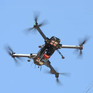
The lightweight (just 2.2 kg / 4.9 lbs) and versatile RIEGL VUX-100-25 offers a large field of view of 160 degrees and a high pulse repetition rate of up to 1500 kHz. This sensor is ideally suited for mapping of complex terrain and narrow canyons. The compact design and the light weight allow smooth integration on various drones and small crewed planes.
The RIEGL VUX-120-23, which weighs only 2.3 kg (4.4 lbs) features up to 2.4 MHz PRR (Pulse Repetition Rate) and delivers up to 400 scan lines and effective 2 million measurements per second on the ground. With its special multi-target capability of up to 32 targets per pulse, the VUX-120-23 penetrates even dense vegetation, which in this case results in a measurement performance of several million measurements per second. Interfaces for the integration of a high-quality IMU/GNSS system and up to two cameras are available.
The RIEGL VUX-160-23 provides up to 2.4 MHz PRR, 400 lines/sec., 10 mm accuracy, 5 mm precision and an extended measurement range of up to 1800 m with only 2.65 kg in weight. It is able to capture up to 32 targets per pulse and thus also offers excellent penetration capabilities, e.g., for applications in forestry. This sensor also supports fully integrated IMU/GNSS electronics for convenient system integration and is prepared for the use with up to 5 cameras.
The RIEGL VUX-120-23 and the RIEGL VUX-160-23 use an innovative scanning pattern for the optimal detection of even vertical targets, such as high-voltage pylons, house facades or steep mountain slopes. In this so-called NFB (Nadir/Forward/Backward) scanning, the 100° wide field of view is scanned in alternating planes (strictly vertical down, +10° forward oblique, -10° backward oblique).
Additionally, the wide field of view enables users to fly parallel to the asset (i.e. side-looking scanning) as opposed to directly over the target. This ability significantly increases safety for applications such as mapping of power line networks.
With these basic technical data, these scanners are ideally suited for the use on fixed-wing UAVs in corridor mapping.
Especially for surveying with high-speed platforms, the RIEGL VUX-180-24 offers a wide field of view of 75° and an extremely high pulse repetition rate of up to 2.4 MHz. These features – in combination with an increased scan speed of up to 800 lines/sec. – make it perfectly suited for applications where an optimal line and point distribution is essential. Typical applications include mapping and monitoring of critical infrastructure like power lines, railway tracks, pipelines, and runways. The RIEGL VUX-180-24 provides mechanical and electrical interfaces for IMU/GNSS integration and up to 5 external cameras.
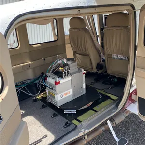
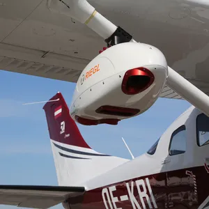
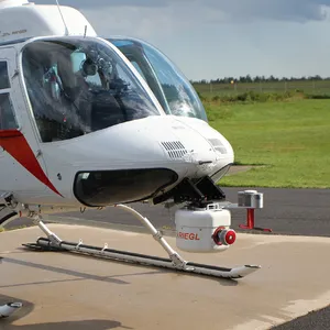
RIEGL UAV LiDAR sensors are available as stand-alone sensors or in various fully integrated laser scanning system configurations with IMU/GNSS system and optional cameras.
With RiLOC-F and RiLOC-F inside RIEGL offers a high-precision, fully integrated IMU/GNSS system for their VUX-series laser scanners. RILOC (RIEGL’s Localization/Orientation/Component) offers tight coupling of IMU/GNSS/LiDAR data, seamless integration into the RIEGLpost-processing workflow and a lightweight and small form factor - the ideal solution for small-scale LiDAR surveying with unmanned platforms such as multirotor, fixed-wing, or VTOL drones.