Lade Informationen...

Verbindingsweg 8
Bedum, Groningen, 9781DA
Niederlande
+31 6 55863073
Smart Delta develops complete mobile mapping systems and geospatial software that enable professionals to capture, process, analyse and visualise the world around them.
Our end-to-end mobile mapping ecosystem combines LiDAR, high-resolution 360° imaging, GNSS/INS positioning, sensor fusion and geospatial analysis.
Smart Delta develops both the hardware and software required for the complete workflow, from data acquisition in the field to processing, visualisation, measurement and analysis.
Our solutions are compact, flexible and easy to deploy. The open Smart Delta ecosystem supports different LiDAR sensors, cameras and positioning technologies and allows customers to integrate the resulting data into their existing geospatial workflows.
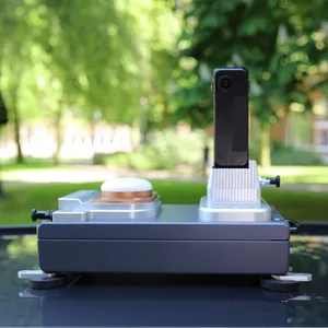
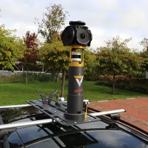
Mobile Mapping Systems
Data Recording Software
Processing Software
GIS, Visualisation and Measurement Software
Our solutions are used in surveying, infrastructure, railways, utilities, smart cities, asset management, industrial environments, digital twins and special transport planning.
By developing mobile mapping systems, recording software, processing software and GIS applications in-house, Smart Delta provides one integrated and efficient workflow. Customers benefit from open data formats, flexible sensor integration, direct technical support and greater control over their data.
Based in the Netherlands, at the heart of Europe, Smart Delta supports customers and partners worldwide with innovative mobile mapping solutions, technical expertise and personal service.
Smart Delta develops complete mobile mapping systems and geospatial software that enable professionals to capture, process, analyse and visualise the world around them.
Our end-to-end mobile mapping ecosystem combines LiDAR, high-resolution 360° imaging, GNSS/INS positioning, sensor fusion and geospatial analysis.
Smart Delta develops both the hardware and software required for the complete workflow, from data acquisition in the field to processing, visualisation, measurement and analysis.
Our solutions are compact, flexible and easy to deploy. The open Smart Delta ecosystem supports different LiDAR sensors, cameras and positioning technologies and allows customers to integrate the resulting data into their existing geospatial workflows.
Mobile Mapping Systems
Data Recording Software
Processing Software
GIS, Visualisation and Measurement Software
Our solutions are used in surveying, infrastructure, railways, utilities, smart cities, asset management, industrial environments, digital twins and special transport planning.
By developing mobile mapping systems, recording software, processing software and GIS applications in-house, Smart Delta provides one integrated and efficient workflow. Customers benefit from open data formats, flexible sensor integration, direct technical support and greater control over their data.
Based in the Netherlands, at the heart of Europe, Smart Delta supports customers and partners worldwide with innovative mobile mapping solutions, technical expertise and personal service.
en
Vermessungssysteme, Positionierung und Navigation, Smart Cities, Software- und Datenmanagement, Daten und Datendienstleistungen, BIM (Building Information Modelling)/ Infrastruktur
9781DA
Verbindingsweg 8