
Lade Informationen...
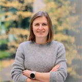
Product Owner
I am passionate about working with data and teams, particularly in the fields of geoinformatics and remote sensing. My educational background in geography and geoinformatics intersects with remote sensing, photogrammetry, machine learning, and computer vision.
For my PhD thesis, titled "Automating Image-Based Cadastral Boundary Mapping," I developed an approach that simplifies land rights mapping by extracting visible cadastral boundaries from remote sensing data. This tool integrates image analysis, machine learning, and GIS functionalities.
In February 2020, I joined Netze BW in the energy and utilities sector as an IT Business Analyst. Since December 2021, I have transitioned to the innovations team at Netze BW. In my current role as a Product Owner, I am responsible for digital vegetation management. I have successfully developed and rolled out two innovative technologies: a web GIS tool that allows technicians to document vegetation management tasks directly in the field, and regular LiDAR surveys that automatically identify and predict critical vegetation. These solutions have significantly enhanced our operational efficiency and precision.



Datum
Vier Jahre Digitalisierung im Freileitungsbetrieb – wir präsentieren die Ergebnisse und Best Practices aus dem Projekt NETZinspect 2.0 der Netze BW! Der Fokus liegt auf dem Einsatz von Geoinformatik und Fernerkundungstechnologien zur Steigerung der Effizienz und Genauigkeit in der Trassenpflege.
Im Mittelpunkt stehen zwei Innovationen: TIP, unser mobiles GIS-Tool, ermöglicht die Erfassung notwendiger Maßnahmen inklusive Bilddokumentation direkt vor Ort und unterstützt die digitale Vegetationskontrolle. LiDAR-Technologie liefert zentimetergenaue Daten zu Einfall- und Einwuchsrisiken, besonders hilfreich in schwer zugänglichem Gelände.
Neben der Digitalisierung der Trassenpflege umfasst NETZinspect 2.0 auch virtuelle Inspektionen per Drohne und eine Mediendatenbank zur Verwaltung von Bild- und 3D-Daten. Der Vortrag zeigt anhand konkreter Beispiele, wie durch agile Projektentwicklung in enger Kooperation mit Power-Usern und die strategische Integration von Fernerkundungsanalysen Trassenmanagement entlang von 3800 km Freileitungen digitalisiert werden kann.